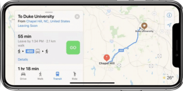
At last, there is more information about the current public transport system in Apple’s map app on iPhone and Co. Does this make the use of Google Maps redundant?
Apple users, too, have not been able to avoid the navigation app Google Maps, at least in Europe. Current traffic information was too thin, especially in public transport. This has now changed with an update of Apple Maps, which is available since the night to Monday. The new version promises an extensive collection of bus and train departure and arrival times and also shows temporary track changes or stop relocations.
So what has been a matter of course for many years in the USA, Apple’s home country, as well as in the Google Maps app, is now finally also possible in Europe, at least in Germany, France and Spain: An all-encompassing route planning including public transport. The next few months will show whether iPhone users in these countries will make more frequent use of Apple maps from now on, however.


